11 Jan Coordinate Systems
Coordinate systems (COS) are used as a method of defining the position of a point in space. In order to create a coordinate system, an origin location and the axis directions are required.
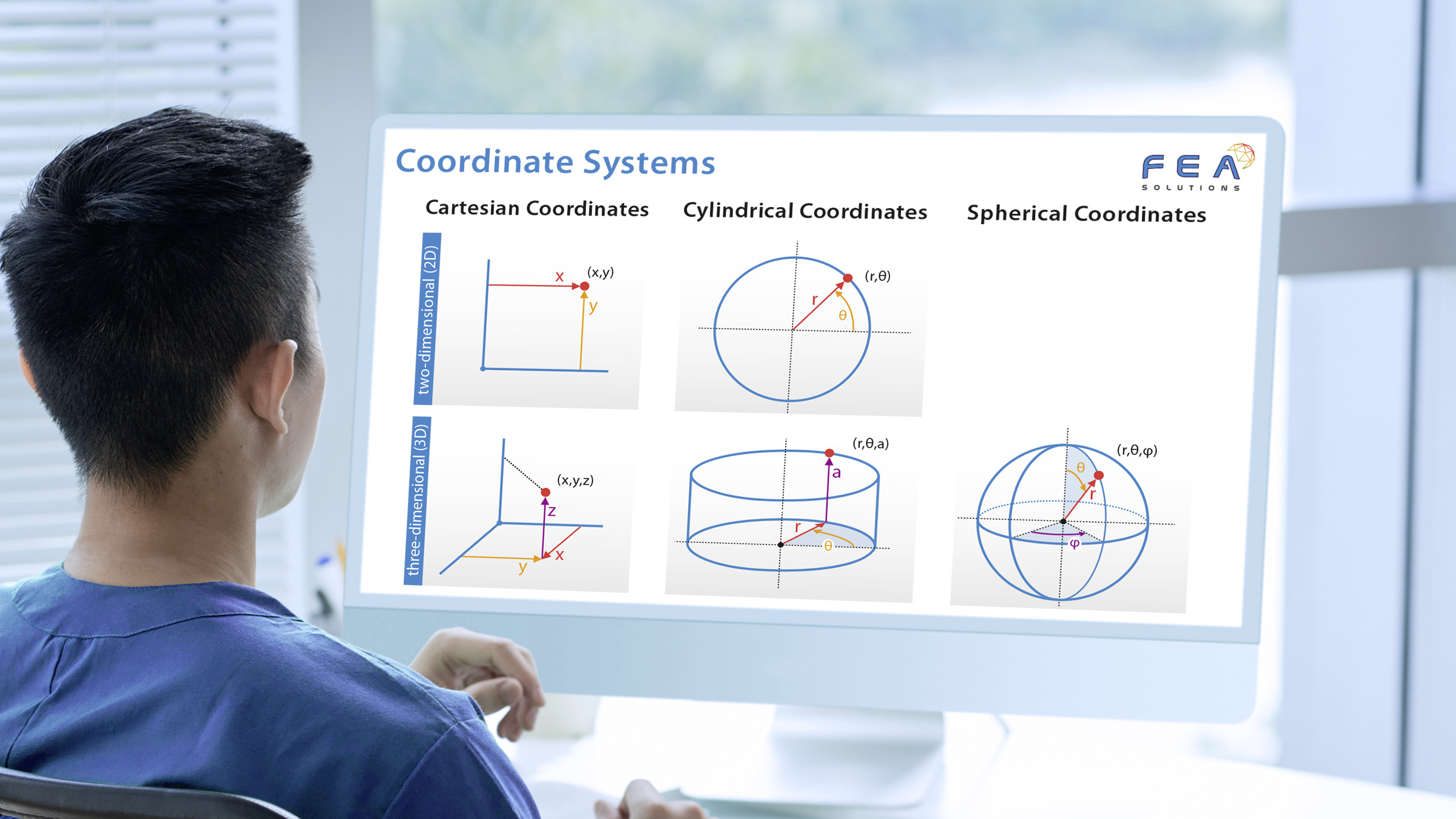
In three-dimensional space, there are the following coordinate systems:
- Cartesian, with the axes x, y and z
- Cylindrical, with the axes r, θ and a
- Spherical, with the axes r, θ and ϕ
Examples where coordinate systems are used in everyday life include street maps (Cartesian), radar maps (Cylindrical) and GPS positioning (Spherical).
The default coordinate system in FEA is Cartesian, as all matrix (https://fea-solutions.co.uk/scalar-vector-and-matrix/) calculations are done using this COS. If a different coordinate system is defined based on the geometry being analysed, the matrix calculation results are transformed from the global Cartesian coordinate system to the local coordinate system (https://fea-solutions.co.uk/global-local-and-element-coordinate-systems/).
Please call us today on +44 (0)1202 798991 for any engineering analysis requirements you might have.